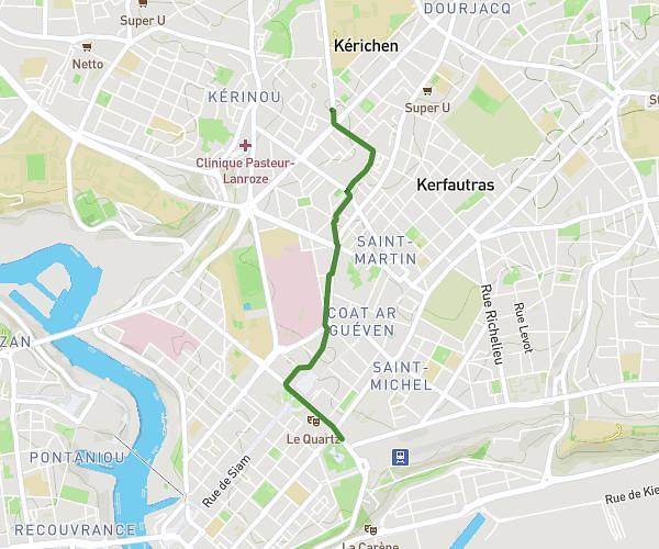
This walking route covers 3.947mi starting from Brest, Finistère. The walk does not return to the trailhead and ends near 14 Rue Branda, 29200 Brest, France. This walk is rated as easy, plan for about 1h43m to complete it. The route has an elevation gain of 643ft and an elevation loss of 505ft.
Brest: Tourist Info to Bibus Shop to Telepherique (East)
Route details
26:06/mi
Pace
421 kcal
Calories burned
Point to point
Route type
-3ft
Min altitude
207ft
Max altitude
Route profile
643ft
Elevation gain
505ft
Elevation loss
-3ft
Min altitude
207ft
Max altitude
How to get there
Trailhead: 195 Belvédère Cesária Évora, 29000 Brest, France
GPS coordinates of the trailhead: 48.38857, -4.49734 / 48°23'18'' N, 4°29'50'' W