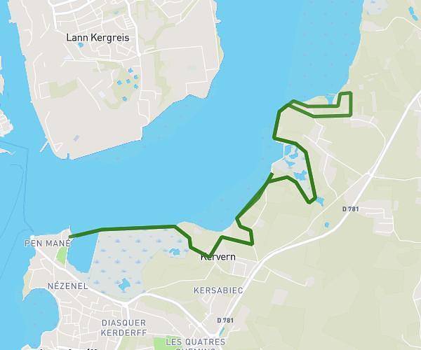
This running route covers 4.635mi starting from Locmiquélic, Morbihan. The run is a loop trail and returns to the trailhead. This run is rated as easy, expect about 50m to complete it. The route has an elevation gain of 338ft and an elevation loss of 338ft.
Tour Locmiquelic 7.5km
Route details
5.56mph
Speed
572 kcal
Calories burned
Loop trail
Route type
-3ft
Min altitude
72ft
Max altitude
Route profile
338ft
Elevation gain
338ft
Elevation loss
-3ft
Min altitude
72ft
Max altitude
How to get there
Trailhead: 101 Rue Du Général De Gaulle, 56570 Locmiquélic, France
GPS coordinates of the trailhead: 47.722805, -3.347101 / 47°43'22'' N, 3°20'49'' W