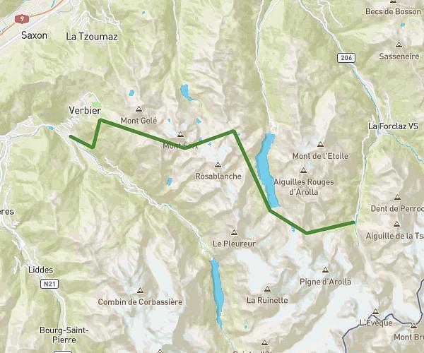
This running route covers 12.639mi starting from La Tzoumaz, Valais. The run is a loop trail and returns to the trailhead. This run is rated as strenuous, expect about 2h2m to complete it. The route has an elevation gain of 2375ft and an elevation loss of 2339ft.
riddes
Route details
6.21mph
Speed
1395 kcal
Calories burned
Loop trail
Route type
4580ft
Min altitude
6955ft
Max altitude
Route profile
2375ft
Elevation gain
2339ft
Elevation loss
4580ft
Min altitude
6955ft
Max altitude
How to get there
Trailhead: Rue Centrale, 1918 La Tzoumaz
GPS coordinates of the trailhead: 46.14518, 7.23387 / 46°8'42'' N, 7°14'1'' E