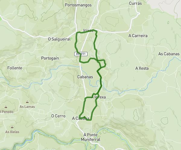
This running route covers 6.123mi starting from Irixoa, A Coruña. The run is a loop trail and returns to the trailhead. This run is rated as moderate, expect about 2h to complete it. The route has an elevation gain of 440ft and an elevation loss of 364ft.
03072025
Route details
3.06mph
Speed
1372 kcal
Calories burned
Loop trail
Route type
978ft
Min altitude
1417ft
Max altitude
Route profile
440ft
Elevation gain
364ft
Elevation loss
978ft
Min altitude
1417ft
Max altitude
How to get there
Trailhead: Lugar A Cabana 3, 15313 Irixoa, A Coruña, Spain
GPS coordinates of the trailhead: 43.25693, -8.06145 / 43°15'24'' N, 8°3'41'' W