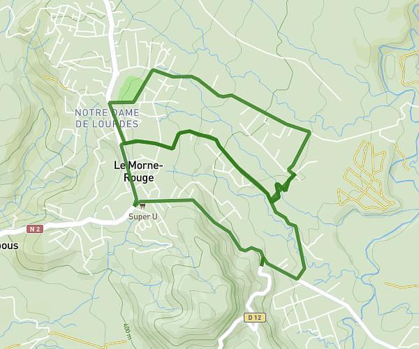
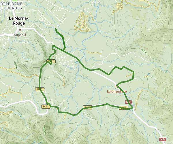
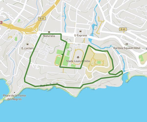
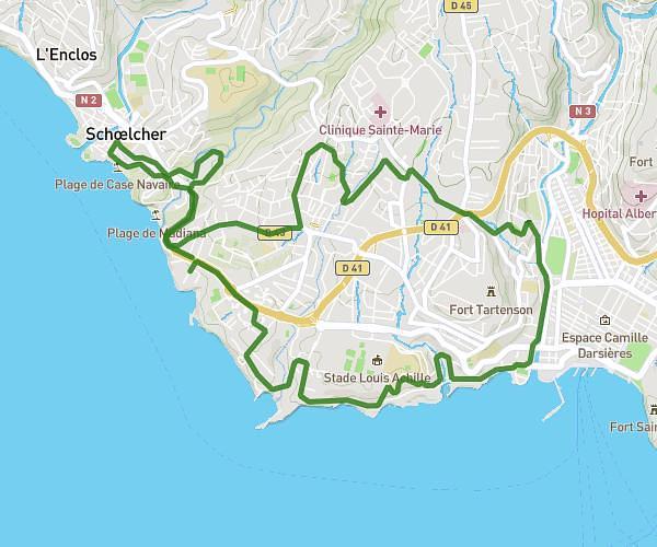
This running route covers 7.822mi starting from Schœlcher, Martinique. The run is a loop trail and returns to the trailhead. This run is rated as hard, expect about 1h16m to complete it. The route has an elevation gain of 991ft and an elevation loss of 965ft.
Entraînement TransMq
Route details
6.18mph
Speed
869 kcal
Calories burned
Loop trail
Route type
23ft
Min altitude
666ft
Max altitude
Route profile
991ft
Elevation gain
965ft
Elevation loss
23ft
Min altitude
666ft
Max altitude
How to get there
Trailhead: 17 Impasse Des Cerises, 97233, Schœlcher, Martinique
GPS coordinates of the trailhead: 14.60824, -61.09643 / 14°36'29'' N, 61°5'47'' W