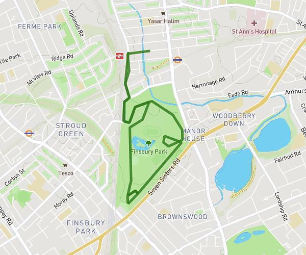
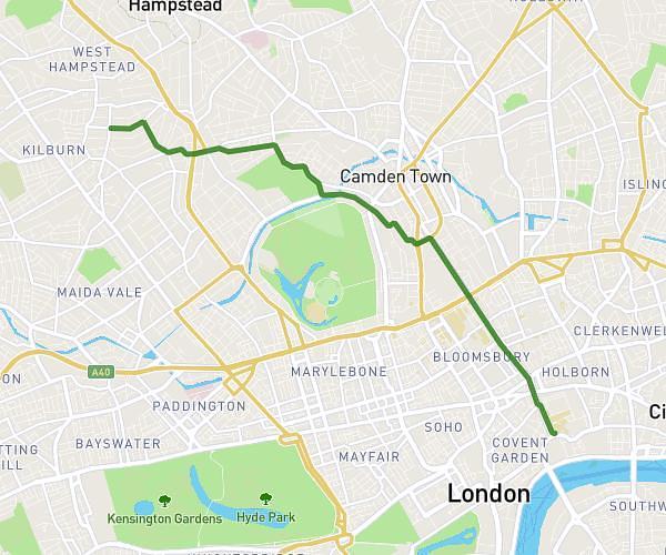
This running route covers 4.991mi starting from London, England. The run is a loop trail and returns to the trailhead. This run is rated as moderate, expect about 54m to complete it. The route has an elevation gain of 367ft and an elevation loss of 367ft.
Regents park
Route details
5.54mph
Speed
617 kcal
Calories burned
Loop trail
Route type
95ft
Min altitude
203ft
Max altitude
Route profile
367ft
Elevation gain
367ft
Elevation loss
95ft
Min altitude
203ft
Max altitude
How to get there
Trailhead: 61 Canfield Gardens, Camden, London, NW6 3JL, United Kingdom
GPS coordinates of the trailhead: 51.544905, -0.18317 / 51°32'41'' N, 0°10'59'' W