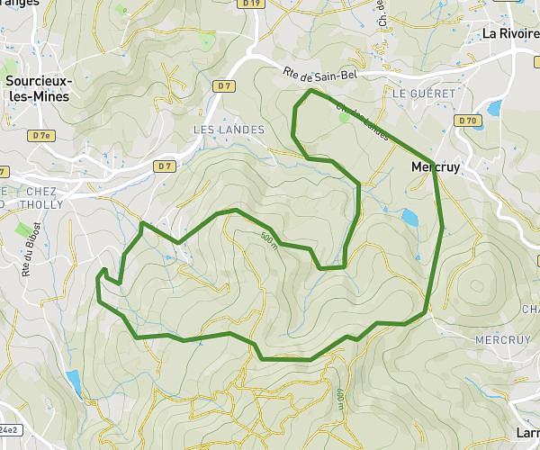
This hiking trail covers 6.4mi starting from Saint-Symphorien-sur-Coise, Rhône. The hike is a loop trail and returns to the trailhead. This hike is rated as hard, plan for about 2h25m to complete it. The route has an elevation gain of 965ft and an elevation loss of 961ft.
balade 02 février 2025 GTO
Route details
2.65mph
Speed
1063 kcal
Calories burned
5.7%
Avg grade
Loop trail
Route type
1729ft
Min altitude
2224ft
Max altitude
Route profile
965ft
Elevation gain
961ft
Elevation loss
1729ft
Min altitude
2224ft
Max altitude
How to get there
Trailhead: 16 Allée Du Manipan, 69590 Saint-Symphorien-sur-Coise, France
GPS coordinates of the trailhead: 45.63388, 4.4664 / 45°38'1'' N, 4°27'59'' E