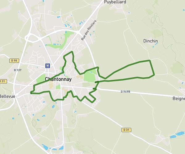
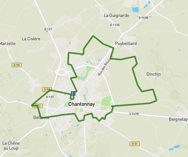
This running route covers 3.002mi starting from Antigny, Vendée. The run is a loop trail and returns to the trailhead. This run is rated as easy, expect about 1h to complete it. The route has an elevation gain of 253ft and an elevation loss of 249ft.
19 décembre 25
Route details
3.0mph
Speed
686 kcal
Calories burned
Loop trail
Route type
236ft
Min altitude
331ft
Max altitude
Route profile
253ft
Elevation gain
249ft
Elevation loss
236ft
Min altitude
331ft
Max altitude
How to get there
Trailhead: 6 Rue Jean-Marie Mélisson, 85120 Antigny, France
GPS coordinates of the trailhead: 46.620357, -0.770165 / 46°37'13'' N, 0°46'12'' W