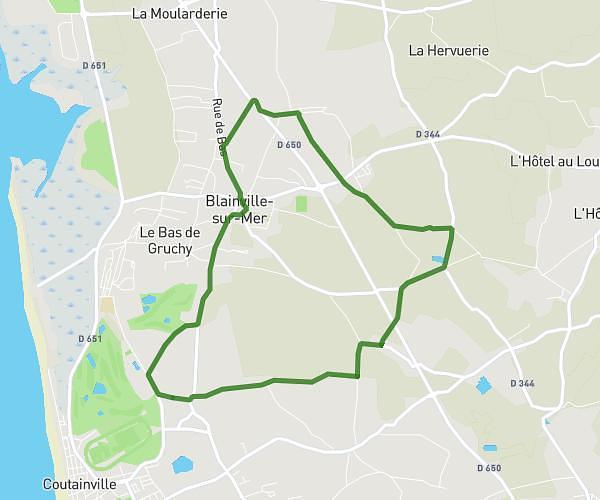
This cycling route covers 17.243mi starting from Chanteloup, Manche. The ride is a loop trail and returns to the trailhead. This route is rated as moderate, plan for about 1h44m to complete it. The route has an elevation gain of 253ft and an elevation loss of 262ft.
Ver la meurdraquière
Route details
913 kcal
Calories burned
0.6%
Avg grade
Loop trail
Route type
141ft
Min altitude
384ft
Max altitude
Route profile
253ft
Elevation gain
262ft
Elevation loss
141ft
Min altitude
384ft
Max altitude
How to get there
Trailhead: 327 Route D'orion, 50510 Chanteloup, France
GPS coordinates of the trailhead: 48.89694, -1.46219 / 48°53'48'' N, 1°27'43'' W