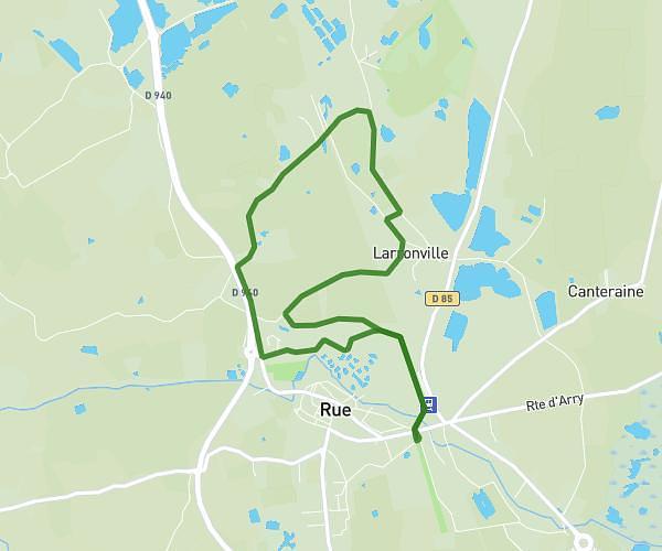
This hiking trail covers 2.384mi starting from Rue, Somme. The hike is a loop trail and returns to the trailhead. This hike is rated as easy, plan for about 1h to complete it. The route has an elevation gain of 75ft and an elevation loss of 75ft.
Ruenne 2026 balade famille courte
Route details
2.39mph
Speed
424 kcal
Calories burned
1.2%
Avg grade
Loop trail
Route type
13ft
Min altitude
30ft
Max altitude
Route profile
75ft
Elevation gain
75ft
Elevation loss
13ft
Min altitude
30ft
Max altitude
How to get there
Trailhead: 6 Place Du Général De Gaulle, 80120 Rue, France
GPS coordinates of the trailhead: 50.271077, 1.674767 / 50°16'15'' N, 1°40'29'' E