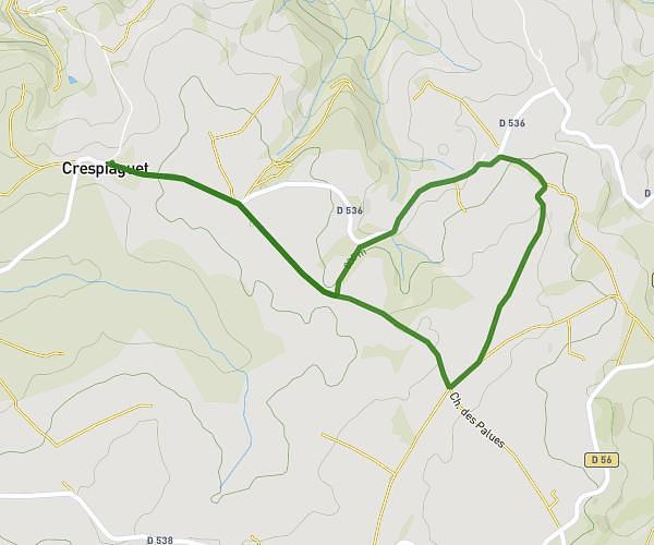
This running route covers 5.125mi starting from Rullac-Saint-Cirq, Aveyron. The run is a loop trail and returns to the trailhead. This run is rated as moderate, expect about 47m to complete it. The route has an elevation gain of 410ft and an elevation loss of 407ft.
Running 1
Route details
6.54mph
Speed
537 kcal
Calories burned
Loop trail
Route type
1936ft
Min altitude
2169ft
Max altitude
Route profile
410ft
Elevation gain
407ft
Elevation loss
1936ft
Min altitude
2169ft
Max altitude
How to get there
Trailhead: Chemin Du Bes, 12120 Rullac-Saint-Cirq, France
GPS coordinates of the trailhead: 44.11209, 2.50506 / 44°6'43'' N, 2°30'18'' E