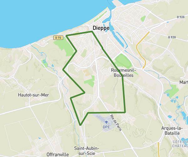
This walking route covers 4.985mi starting from Dieppe, Seine-Maritime. The walk is a loop trail and returns to the trailhead. This walk is rated as hard, plan for about 1h47m to complete it. The route has an elevation gain of 535ft and an elevation loss of 535ft.
le plessis-mont robin
Route details
21:27/mi
Pace
437 kcal
Calories burned
Loop trail
Route type
26ft
Min altitude
315ft
Max altitude
Route profile
535ft
Elevation gain
535ft
Elevation loss
26ft
Min altitude
315ft
Max altitude
How to get there
Trailhead: 3 Rue Alexandre Legros, 76200 Dieppe, France
GPS coordinates of the trailhead: 49.91731, 1.06862 / 49°55'2'' N, 1°4'7'' E