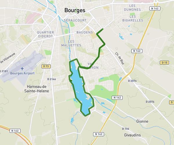
This running route covers 2.507mi starting from Bourges, Cher. The run does not return to the trailhead and ends near 12a Avenue De Gionne, 18000 Bourges, France. This run is rated as easy, expect about 19m40s to complete it. The route has an elevation gain of 115ft and an elevation loss of 85ft.
dfvbk
Route details
7.65mph
Speed
225 kcal
Calories burned
Point to point
Route type
417ft
Min altitude
531ft
Max altitude
Route profile
115ft
Elevation gain
85ft
Elevation loss
417ft
Min altitude
531ft
Max altitude
How to get there
Trailhead: Rue De L'alchimie, 18000 Bourges, France
GPS coordinates of the trailhead: 47.08202, 2.40137 / 47°4'55'' N, 2°24'4'' E