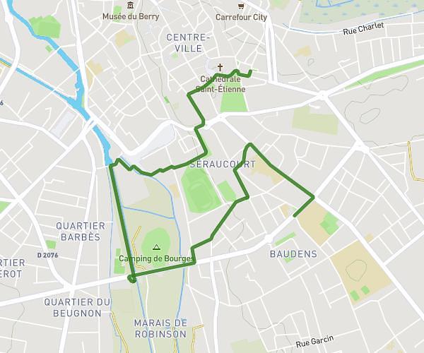
This running route covers 7.09mi starting from Bourges, Cher. The run is a loop trail and returns to the trailhead. This run is rated as moderate, expect about 59m to complete it. The route has an elevation gain of 433ft and an elevation loss of 423ft.
11 km Bourges
Route details
7.21mph
Speed
675 kcal
Calories burned
Loop trail
Route type
410ft
Min altitude
512ft
Max altitude
Route profile
433ft
Elevation gain
423ft
Elevation loss
410ft
Min altitude
512ft
Max altitude
How to get there
Trailhead: 53 Avenue Carnot, 18000 Bourges, France
GPS coordinates of the trailhead: 47.074244, 2.414296 / 47°4'27'' N, 2°24'51'' E