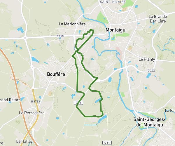
This running route covers 2.867mi starting from Chavagnes-en-Paillers, Vendée. The run is a loop trail and returns to the trailhead. This run is rated as easy, expect about 30m45s to complete it. The route has an elevation gain of 233ft and an elevation loss of 233ft.
La bleure
Route details
5.59mph
Speed
352 kcal
Calories burned
Loop trail
Route type
141ft
Min altitude
213ft
Max altitude
Route profile
233ft
Elevation gain
233ft
Elevation loss
141ft
Min altitude
213ft
Max altitude
How to get there
Trailhead: 30 La Martelière, 85250 Chavagnes-en-Paillers, France
GPS coordinates of the trailhead: 46.90624, -1.24396 / 46°54'22'' N, 1°14'38'' W