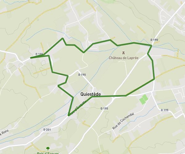
This hiking trail covers 4.515mi starting from Heuringhem, Pas-de-Calais. The hike is a loop trail and returns to the trailhead. This hike is rated as easy, plan for about 1h48m to complete it. The route has an elevation gain of 328ft and an elevation loss of 328ft.
Heuringhem
Route details
2.49mph
Speed
780 kcal
Calories burned
2.8%
Avg grade
Loop trail
Route type
108ft
Min altitude
272ft
Max altitude
Route profile
328ft
Elevation gain
328ft
Elevation loss
108ft
Min altitude
272ft
Max altitude
How to get there
Trailhead: 420 Rue Des Bruyères, 62575 Heuringhem, France
GPS coordinates of the trailhead: 50.702973, 2.279843 / 50°42'10'' N, 2°16'47'' E