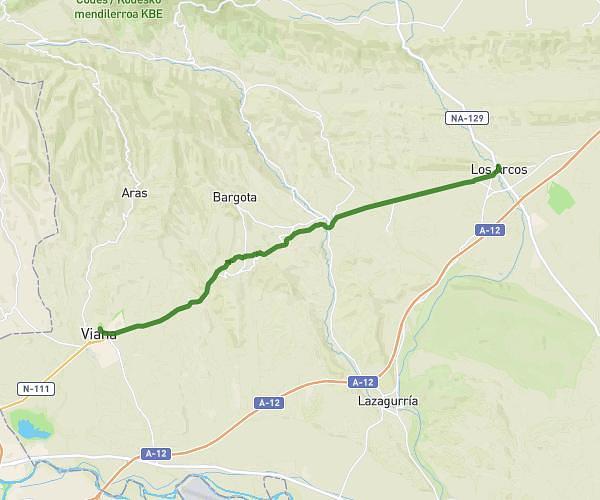
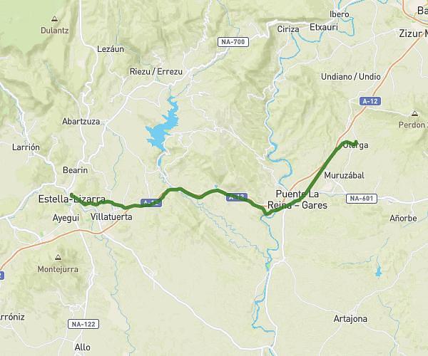
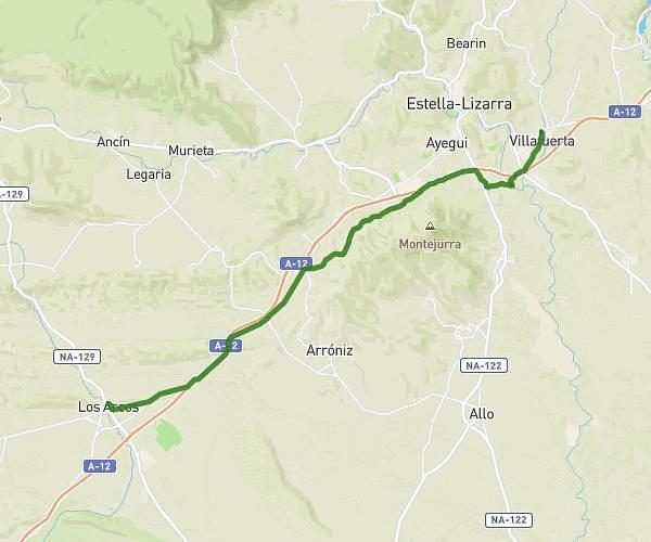
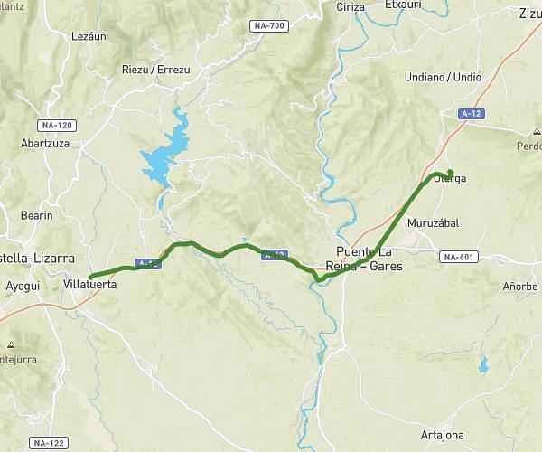
This hiking trail covers 12.259mi starting from Estella-Lizarra, Navarre. The hike does not return to the trailhead and ends near Calle Las Cuestas 10, 31210 Los Arcos, Navarre, Spain. This hike is rated as hard, plan for about 4h to complete it. The route has an elevation gain of 1033ft and an elevation loss of 971ft.
Description of the route by the creator
[19:05, 02/06/2023] Muriel: Hi everyone, Belote and rebelote: The pilgrim walker has done it again! he was due to arrive in Los Arcos this evening, after a 21 km walk.... He found himself a companion as delirious as himself, and they went on for another 27 km to perfect the curve of their English cockerel calves! So tonight they're sleeping in Viana, and 10km from Logroño, which was supposed to be tomorrow night's finish. It's hard to keep up with this little guy! So when I got him on the line, he had Manolo on the phone, to whom he was happy to pass his best new Spanish friend😂 [19:20, 02/06/2023] Muriel: I asked him if he'd doped himself on red wine this morning at the Iraxe🍷 fountain. Not even! They didn't even see it, they didn't go past. I thought he was the only one addicted to fast walking, but apparently he's found his twin, and if they go all the way together, he'll come back to us bilingual!!!! Tonight they were in a restaurant that was an annex of the UN, given the stock of nationalities he quoted to me: English, Spanish, French (of course!), Japanese, American and South American. A real melting pot! He ditched me to order and eat, because he was a bit tired 🥹 (you amaze me😂) and he wanted to go to sleep rather quickly. So tomorrow evening it won't be Logroño as he'll be there from breakfast. So maybe Najera .... or somewhere else! Have a good evening. La bizzz and @+