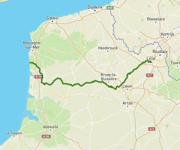
This cycling route covers 10.323mi starting from Tournai, Hainaut. The ride does not return to the trailhead and ends near Cour Lepers, 59150 Wattrelos, France. This route is rated as easy, plan for about 49m50s to complete it. The route has an elevation gain of 49ft and an elevation loss of 407ft.
SAINT AUBERT
Route details
437 kcal
Calories burned
0.8%
Avg grade
Point to point
Route type
56ft
Min altitude
463ft
Max altitude
Route profile
49ft
Elevation gain
407ft
Elevation loss
56ft
Min altitude
463ft
Max altitude
How to get there
Trailhead: Place Du Mont Saint-Aubert 4, 7542 Tournai, Hainaut, Belgium
GPS coordinates of the trailhead: 50.65488, 3.39991 / 50°39'17'' N, 3°23'59'' E