MapPlanner
17.577mi
Distance
1h46m
Duration
9.95mph
Speed
+604ft
Elevation gain
-633ft
Elevation loss
Moderate
Level

`VAUTOUR TC

Route details

936 kcal
Calories burned
1.3%
Avg grade
Point to point
Route type
43ft
Min altitude
121ft
Max altitude

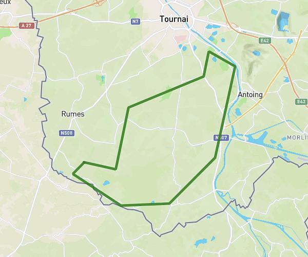
This cycling route covers 17.577mi starting from Tournai, Hainaut. The ride does not return to the trailhead and ends near Rue De France, 7642 Antoing. This route is rated as moderate, plan for about 1h46m to complete it. The route has an elevation gain of 604ft and an elevation loss of 633ft.

Route profile

604ft
Elevation gain
633ft
Elevation loss
43ft
Min altitude
121ft
Max altitude

How to get there

Trailhead: Rue De La Trondeloire, 7536 Tournai

GPS coordinates of the trailhead: 50.59085, 3.43232 / 50°35'27'' N, 3°25'56'' E

Caution: May Cross Private Property

This route may pass through or near private property. Always respect posted signs, obtain permission where required, and follow local trespassing laws. MapPlanner does not guarantee public access along any route.

Safety Notice

Trail and road conditions may change without notice due to weather, construction, or other factors. Always verify current conditions before heading out. You are responsible for your own safety — follow local signage, obey traffic laws, and use your best judgment on the trail.