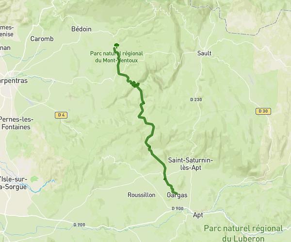
This hiking trail covers 13.263mi starting from Le Barroux, Vaucluse. The hike does not return to the trailhead and ends near Piste Du Bâtiment, 84410 Bédoin, France. This hike has no defined difficulty level, plan for about 4h57m to complete it. The route has an elevation gain of 5584ft and an elevation loss of 5033ft.
Raid Cimes jour 1
Route details
2.68mph
Speed
2355 kcal
Calories burned
15.2%
Avg grade
Point to point
Route type
Steep climb
Route profile
5584ft
Elevation gain
5033ft
Elevation loss
How to get there
Trailhead: 1201 Chemin Des Rabassières, 84330 Le Barroux, France
GPS coordinates of the trailhead: 44.15186, 5.09835 / 44°9'6'' N, 5°5'54'' E