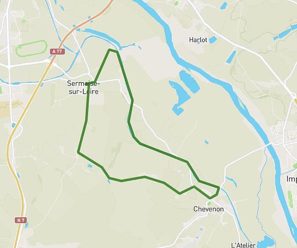
This walking route covers 7.666mi starting from Sermoise-sur-Loire, Nièvre. The walk is a loop trail and returns to the trailhead. This walk is rated as strenuous, plan for about 2h13m to complete it. The route has an elevation gain of 246ft and an elevation loss of 246ft.
Rando 4/12/2024
Route details
17:20/mi
Pace
543 kcal
Calories burned
Loop trail
Route type
548ft
Min altitude
591ft
Max altitude
Route profile
246ft
Elevation gain
246ft
Elevation loss
548ft
Min altitude
591ft
Max altitude
How to get there
Trailhead: Passerelle D'écluse De Verville, 58000 Sermoise-sur-Loire, France
GPS coordinates of the trailhead: 46.95984, 3.18142 / 46°57'35'' N, 3°10'53'' E