MapPlanner
0.902mi
Distance
11h32m
Duration
+213ft
Elevation gain
-213ft
Elevation loss
Easy
Level

parcours 1

Route details

1.86mph
Speed
5206 kcal
Calories burned
9.0%
Avg grade
Loop trail
Route type
151ft
Min altitude
322ft
Max altitude
Steep climb

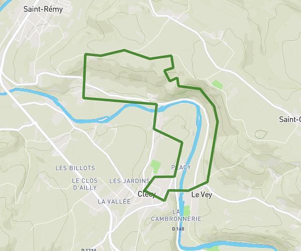
This hiking trail covers 0.902mi starting from Clécy, Calvados. The hike is a loop trail and returns to the trailhead. This hike is rated as easy, plan for about 11h32m to complete it. The route has an elevation gain of 213ft and an elevation loss of 213ft.

Route profile

213ft
Elevation gain
213ft
Elevation loss
151ft
Min altitude
322ft
Max altitude

How to get there

Trailhead: D 168, 14570 Clécy

GPS coordinates of the trailhead: 48.90887, -0.47069 / 48°54'31'' N, 0°28'14'' W

Caution: May Cross Private Property

This route may pass through or near private property. Always respect posted signs, obtain permission where required, and follow local trespassing laws. MapPlanner does not guarantee public access along any route.

Safety Notice

Trail and road conditions may change without notice due to weather, construction, or other factors. Always verify current conditions before heading out. You are responsible for your own safety — follow local signage, obey traffic laws, and use your best judgment on the trail.