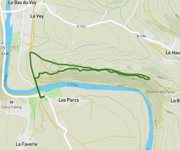
This hiking trail covers 3.043mi starting from Clécy, Calvados. The hike is a loop trail and returns to the trailhead. This hike is rated as moderate, plan for about 20h56m to complete it. The route has an elevation gain of 787ft and an elevation loss of 787ft.
parcours 3
Route details
0.14mph
Speed
9517 kcal
Calories burned
9.8%
Avg grade
Loop trail
Route type
144ft
Min altitude
797ft
Max altitude
Steep climb
Route profile
787ft
Elevation gain
787ft
Elevation loss
144ft
Min altitude
797ft
Max altitude
How to get there
Trailhead: D 168, 14570 Clécy
GPS coordinates of the trailhead: 48.90886, -0.47062 / 48°54'31'' N, 0°28'14'' W