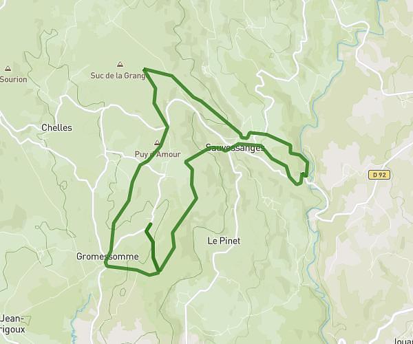
This running route covers 3.048mi starting from Usson-en-Forez, Loire. The run is a loop trail and returns to the trailhead. This run is rated as easy, expect about 25m57s to complete it. The route has an elevation gain of 325ft and an elevation loss of 322ft.
5km
Route details
7.05mph
Speed
297 kcal
Calories burned
Loop trail
Route type
2979ft
Min altitude
3146ft
Max altitude
Route profile
325ft
Elevation gain
322ft
Elevation loss
2979ft
Min altitude
3146ft
Max altitude
How to get there
Trailhead: Route Nationale, 42550 Usson-en-Forez
GPS coordinates of the trailhead: 45.39061, 3.94018 / 45°23'26'' N, 3°56'24'' E