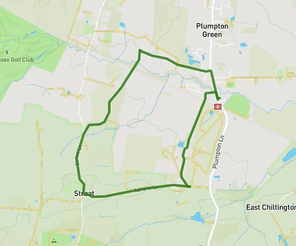
This walking route covers 1.777mi starting from Lewes, England. The walk is a loop trail and returns to the trailhead. This walk is rated as easy, plan for about 38m to complete it. The route has an elevation gain of 430ft and an elevation loss of 430ft.
Plumpton Bostal
Route details
21:22/mi
Pace
155 kcal
Calories burned
Loop trail
Route type
285ft
Min altitude
692ft
Max altitude
Route profile
430ft
Elevation gain
430ft
Elevation loss
285ft
Min altitude
692ft
Max altitude
How to get there
Trailhead: Ditchling Road, Plumpton, Lewes, BN7 3AJ, United Kingdom
GPS coordinates of the trailhead: 50.902584, -0.061485 / 50°54'9'' N, 0°3'41'' W