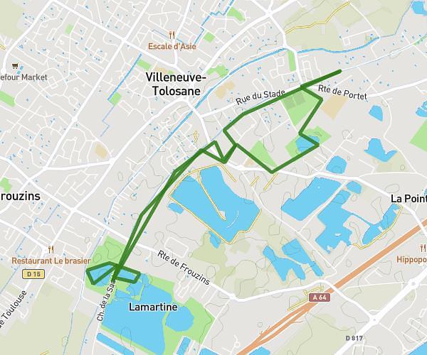
This running route covers 5.182mi starting from Toulouse, Haute-Garonne. The run is a loop trail and returns to the trailhead. This run is rated as moderate, expect about 55m36s to complete it. The route has an elevation gain of 358ft and an elevation loss of 364ft.
Toulouse Elinor Orstrom Quais et Garonne 8km
Route details
5.59mph
Speed
636 kcal
Calories burned
Loop trail
Route type
436ft
Min altitude
518ft
Max altitude
Route profile
358ft
Elevation gain
364ft
Elevation loss
436ft
Min altitude
518ft
Max altitude
How to get there
Trailhead: 18 Boulevard Lascrosses, 31000 Toulouse, France
GPS coordinates of the trailhead: 43.61102, 1.43645 / 43°36'39'' N, 1°26'11'' E