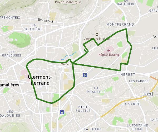
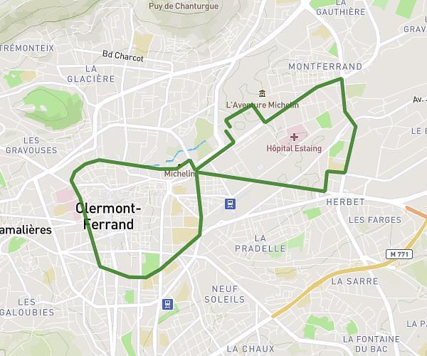
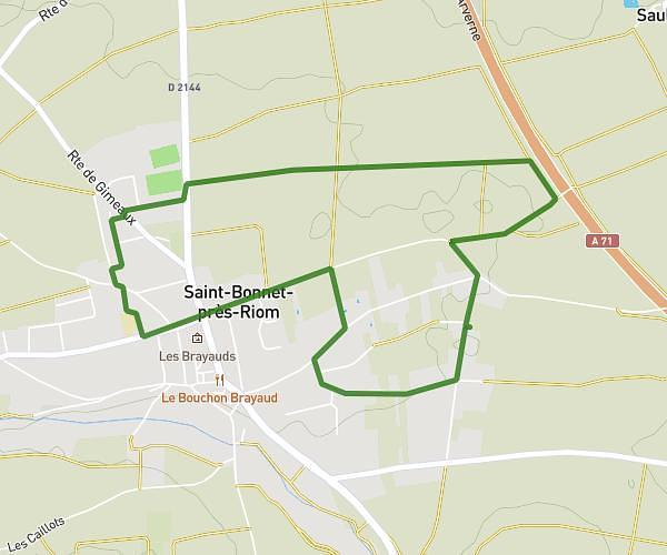
This running route covers 2.964mi starting from Saint-Bonnet-près-Riom, Puy-de-Dôme. The run is a loop trail and returns to the trailhead. This run is rated as easy, expect about 32m to complete it. The route has an elevation gain of 118ft and an elevation loss of 115ft.
La brayaudes
Route details
5.56mph
Speed
366 kcal
Calories burned
Loop trail
Route type
1142ft
Min altitude
1260ft
Max altitude
Route profile
118ft
Elevation gain
115ft
Elevation loss
1142ft
Min altitude
1260ft
Max altitude
How to get there
Trailhead: 4 Rue Savaron, 63200 Saint-Bonnet-près-Riom, France
GPS coordinates of the trailhead: 45.927364, 3.112647 / 45°55'38'' N, 3°6'45'' E