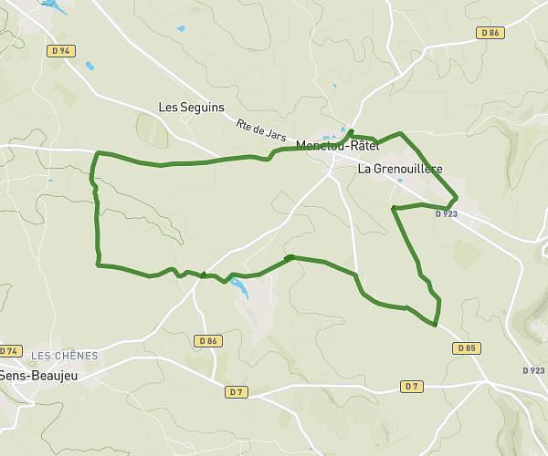
This hiking trail covers 3.93mi starting from Menetou-Râtel, Cher. The hike is a loop trail and returns to the trailhead. This hike is rated as easy, plan for about 1h27m to complete it. The route has an elevation gain of 364ft and an elevation loss of 358ft.
Petit poisson -petit roussignou
Route details
2.71mph
Speed
627 kcal
Calories burned
3.5%
Avg grade
Loop trail
Route type
968ft
Min altitude
1142ft
Max altitude
Route profile
364ft
Elevation gain
358ft
Elevation loss
968ft
Min altitude
1142ft
Max altitude
How to get there
Trailhead: 22 Rue De L'église, 18300 Menetou-Râtel, France
GPS coordinates of the trailhead: 47.353702, 2.757923 / 47°21'13'' N, 2°45'28'' E