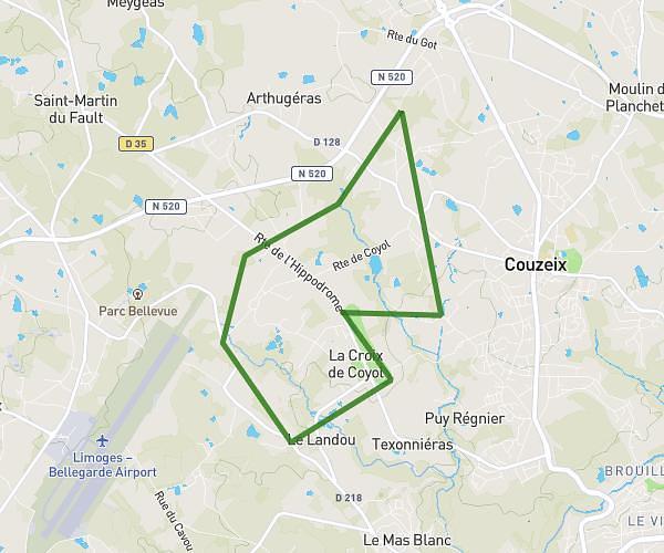
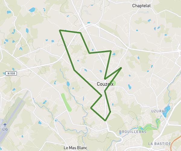
This running route covers 12.652mi starting from Couzeix, Haute-Vienne. The run is a loop trail and returns to the trailhead. This run is rated as strenuous, expect about 2h15m to complete it. The route has an elevation gain of 1007ft and an elevation loss of 1007ft.
Teste 20 km
Route details
5.62mph
Speed
1544 kcal
Calories burned
Loop trail
Route type
984ft
Min altitude
1411ft
Max altitude
Route profile
1007ft
Elevation gain
1007ft
Elevation loss
984ft
Min altitude
1411ft
Max altitude
How to get there
Trailhead: 17 Chemin De Nieul, 87270 Couzeix, France
GPS coordinates of the trailhead: 45.90708, 1.20603 / 45°54'25'' N, 1°12'21'' E