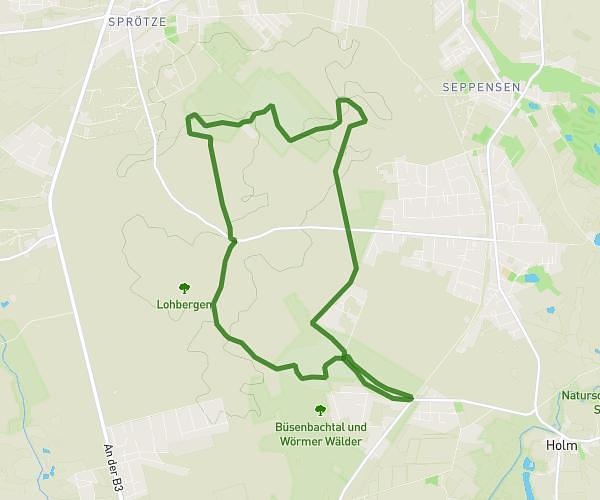
This hiking trail covers 2.632mi starting from Buxtehude, Lower Saxony. The hike is a loop trail and returns to the trailhead. This hike is rated as easy, plan for about 52m57s to complete it. The route has an elevation gain of 118ft and an elevation loss of 121ft.
Kohltour
Route details
2.98mph
Speed
376 kcal
Calories burned
1.7%
Avg grade
Loop trail
Route type
-10ft
Min altitude
39ft
Max altitude
Route profile
118ft
Elevation gain
121ft
Elevation loss
-10ft
Min altitude
39ft
Max altitude
How to get there
Trailhead: Konopkastraße 30, 21614 Buxtehude, Germany
GPS coordinates of the trailhead: 53.47924, 9.6967 / 53°28'45'' N, 9°41'48'' E