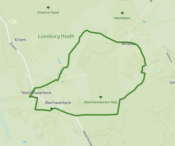
This hiking trail covers 8.174mi starting from Tostedt, Lower Saxony. The hike is a loop trail and returns to the trailhead. This hike is rated as moderate, plan for about 3h17m to complete it. The route has an elevation gain of 607ft and an elevation loss of 607ft.
Brunsberg – Naturschutzgebiet Brunsberg Runde von Holm-Seppensen
Route details
2.49mph
Speed
1411 kcal
Calories burned
2.8%
Avg grade
Loop trail
Route type
167ft
Min altitude
390ft
Max altitude
Route profile
607ft
Elevation gain
607ft
Elevation loss
167ft
Min altitude
390ft
Max altitude
How to get there
Trailhead: Lohbergen, 21255 Tostedt, Germany
GPS coordinates of the trailhead: 53.28586, 9.8254 / 53°17'9'' N, 9°49'31'' E