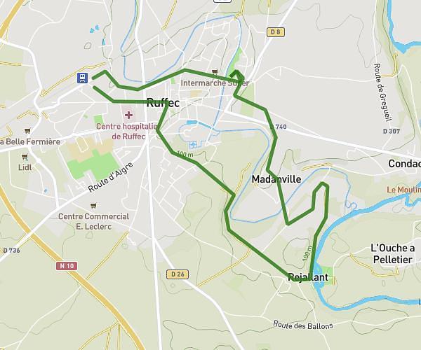
Explore this hiking route of 5,05mi starting from Ruffec, Charente. The hike is a loop and returns to the starting point. This hike has no defined difficulty level, plan for about 1h38m to complete it. The route has a positive elevation gain of 348ft and a negative elevation loss of 351ft.
Promenade forestière
Route details
Route profile
348ft
Elevation +
351ft
Elevation -
289ft
Min altitude
427ft
Max altitude
How to get there
Route starting point: 48 Rue Gambetta, 16700 Ruffec, France
GPS coordinates of the starting point: 46.03024, 0.19071 / 46°1'48'' N, 0°11'26'' E