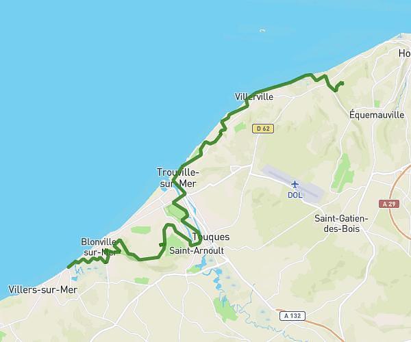
This hiking trail covers 10.872mi starting from Trouville-sur-Mer, Calvados. The hike does not return to the trailhead and ends near Chapelle Notre-Dame-de-Grâce, 14600 Équemauville. This hike is rated as moderate, plan for about 8h45m to complete it. The route has an elevation gain of 581ft and an elevation loss of 699ft.
Pèlerinage
Route details
1.25mph
Speed
3737 kcal
Calories burned
2.2%
Avg grade
Point to point
Route type
102ft
Min altitude
459ft
Max altitude
Route profile
581ft
Elevation gain
699ft
Elevation loss
102ft
Min altitude
459ft
Max altitude
How to get there
Trailhead: Chemin De Callenville, 14360 Trouville-sur-Mer
GPS coordinates of the trailhead: 49.37262, 0.1161 / 49°22'21'' N, 0°6'57'' E