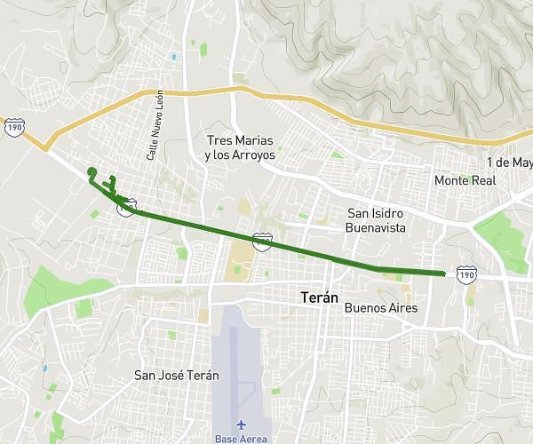
This running route covers 5.61mi starting from Tuxtla Gutiérrez, Chiapas. The run does not return to the trailhead and ends near Boulevard Doctor Belisario Domínguez 3465, Tuxtla Gutiérrez, Chiapas, Mexico. This run is rated as moderate, expect about 54m to complete it. The route has an elevation gain of 144ft and an elevation loss of 308ft.
shirley yamileth LM
Route details
6.23mph
Speed
617 kcal
Calories burned
Point to point
Route type
1864ft
Min altitude
2037ft
Max altitude
Route profile
144ft
Elevation gain
308ft
Elevation loss
1864ft
Min altitude
2037ft
Max altitude
How to get there
Trailhead: Baja California 3, 29020 Tuxtla Gutiérrez, Chiapas, Mexico
GPS coordinates of the trailhead: 16.76648, -93.18984 / 16°45'59'' N, 93°11'23'' W