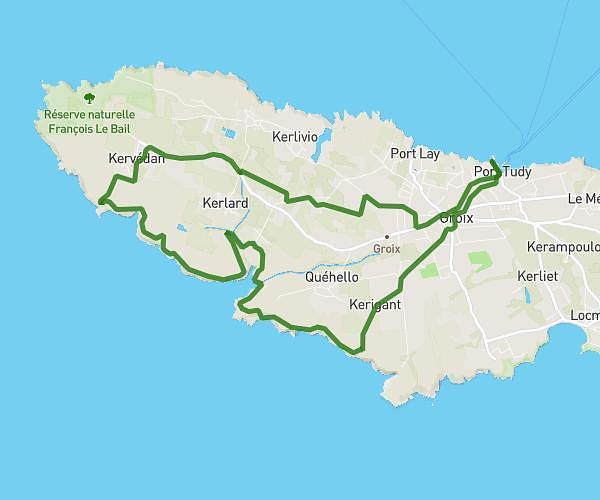
This hiking trail covers 9.514mi starting from Groix, Morbihan. The hike is a loop trail and returns to the trailhead. This hike is rated as moderate, plan for about 3h20m to complete it. The route has an elevation gain of 492ft and an elevation loss of 492ft.
Groix - rando light
Route details
2.85mph
Speed
1423 kcal
Calories burned
2.0%
Avg grade
Loop trail
Route type
10ft
Min altitude
138ft
Max altitude
Route profile
492ft
Elevation gain
492ft
Elevation loss
10ft
Min altitude
138ft
Max altitude
How to get there
Trailhead: 6 Quai Port Tudy, 56590 Groix, France
GPS coordinates of the trailhead: 47.64376, -3.44836 / 47°38'37'' N, 3°26'54'' W