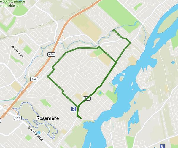
This running route covers 1.88mi starting from Terrebonne, Quebec. The run is a loop trail and returns to the trailhead. This run is rated as easy, expect about 20m to complete it. The route has an elevation gain of 30ft and an elevation loss of 0ft.
Jogging 1
Route details
5.64mph
Speed
229 kcal
Calories burned
Loop trail
Route type
85ft
Min altitude
115ft
Max altitude
Route profile
30ft
Elevation gain
0ft
Elevation loss
85ft
Min altitude
115ft
Max altitude
How to get there
Trailhead: 983 Rue Desjordy, Terrebonne, Quebec J6X 1P7, Canada
GPS coordinates of the trailhead: 45.707278, -73.663327 / 45°42'26'' N, 73°39'47'' W