MapPlanner
Subscribe to Explorer
km
Kilometers
Miles
France (€)
Belgique (€)
United Kingdom (£)
Ireland (€)
United States ($)
Canada ($CA)
Italia (€)
Deutschland (€)
Österreich (€)
España (€)
Schweiz (CHF)
Australia (AU$)
Open user menu
Sign up
Log in
Open main menu
Calculate distance
Search for a route
MapPlanner
Close menu
Subscribe to Explorer
Draw your route
Search for a route
Create an Account
Close modal
Log In
Close modal
MapPlanner
2 km
Elevation
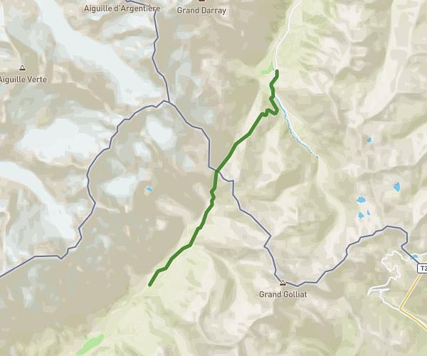
15.52km
Distance
7h45m
Duration
2.0km/h
Speed
465m
Elevation +
1423m
Elevation -
1551m
Minimum altitude
2509m
Maximum altitude
TMB - J4
Hiking
Skayne
Italy
Aosta Valley
Courmayeur
Hikes
Route details
11013 Courmayeur / 5a, 11013 Courmayeur
Round-trip address
Export route as GPX
Discover nearby hiking trails
Hiking
ALPES
275,54
km
•
+9364
m
Haute-Savoie - Sixt-Fer-à-Cheval
Hiking
ETAPE 7 - TMB
12,15
km
•
4
h
2
m
•
+771
m
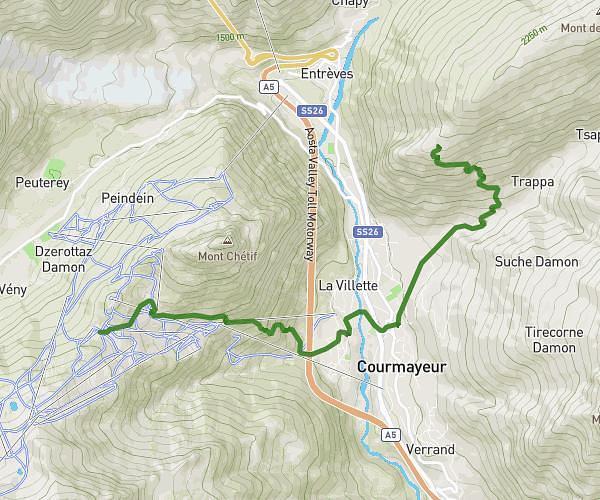
Aosta Valley - Courmayeur
Hiking
Etape 2
9,21
km
•
2
h
16
m
•
+815
m
Aosta Valley - Courmayeur
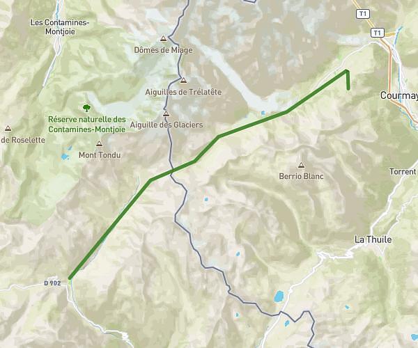
Hiking
Etape 1
23,83
km
•
7
h
7
m
•
+1338
m
Savoie - Bourg-Saint-Maurice
Success
Success
Success
Success
Close