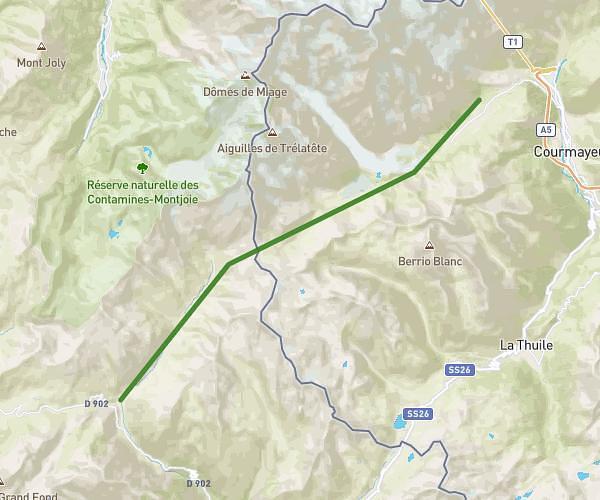
This hiking trail covers 14.807mi starting from Bourg-Saint-Maurice, Savoie. The hike does not return to the trailhead and ends near 6-Tmb-Av2, 11013 Courmayeur. This hike is rated as strenuous, plan for about 7h7m to complete it. The route has an elevation gain of 4390ft and an elevation loss of 3081ft.
Etape 1
Route details
2.08mph
Speed
3269 kcal
Calories burned
9.6%
Avg grade
Point to point
Route type
5098ft
Min altitude
8228ft
Max altitude
High altitude
Steep climb
Route profile
4390ft
Elevation gain
3081ft
Elevation loss
5098ft
Min altitude
8228ft
Max altitude
How to get there
Trailhead: Route De La Ville Des Glaciers, 73700 Bourg-Saint-Maurice
GPS coordinates of the trailhead: 45.6972, 6.7343 / 45°41'49'' N, 6°44'3'' E