MapPlanner
4.971mi
Distance
7h2m
Duration
+2966ft
Elevation gain
-2946ft
Elevation loss
Hard
Level

Dent du chat depuis le Col du Chat

Molard Noir on the way up
Difficult passage with the ladders just before the summit
View to the west from the Dent
View on the end of the lake of Bourget and the Grand Colombier from the tooth
Aix-Les-Bains and the Revard from the top

Route details

0.98mph
Speed
3512 kcal
Calories burned
22.5%
Avg grade
Loop trail
Route type
2093ft
Min altitude
4551ft
Max altitude
Steep climb

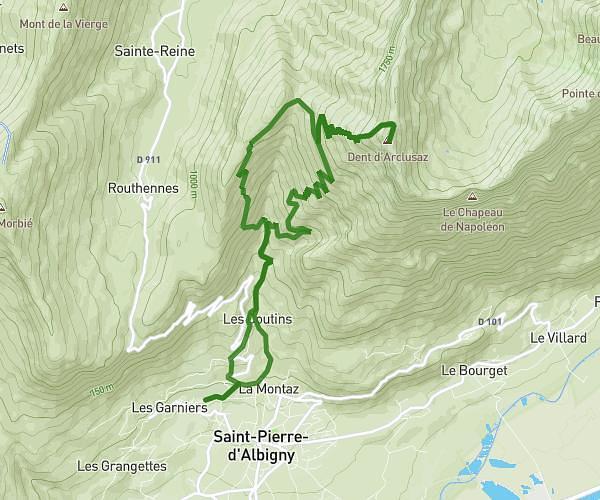
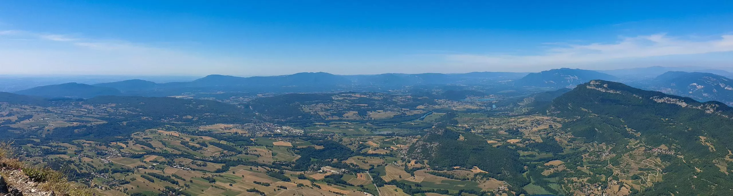
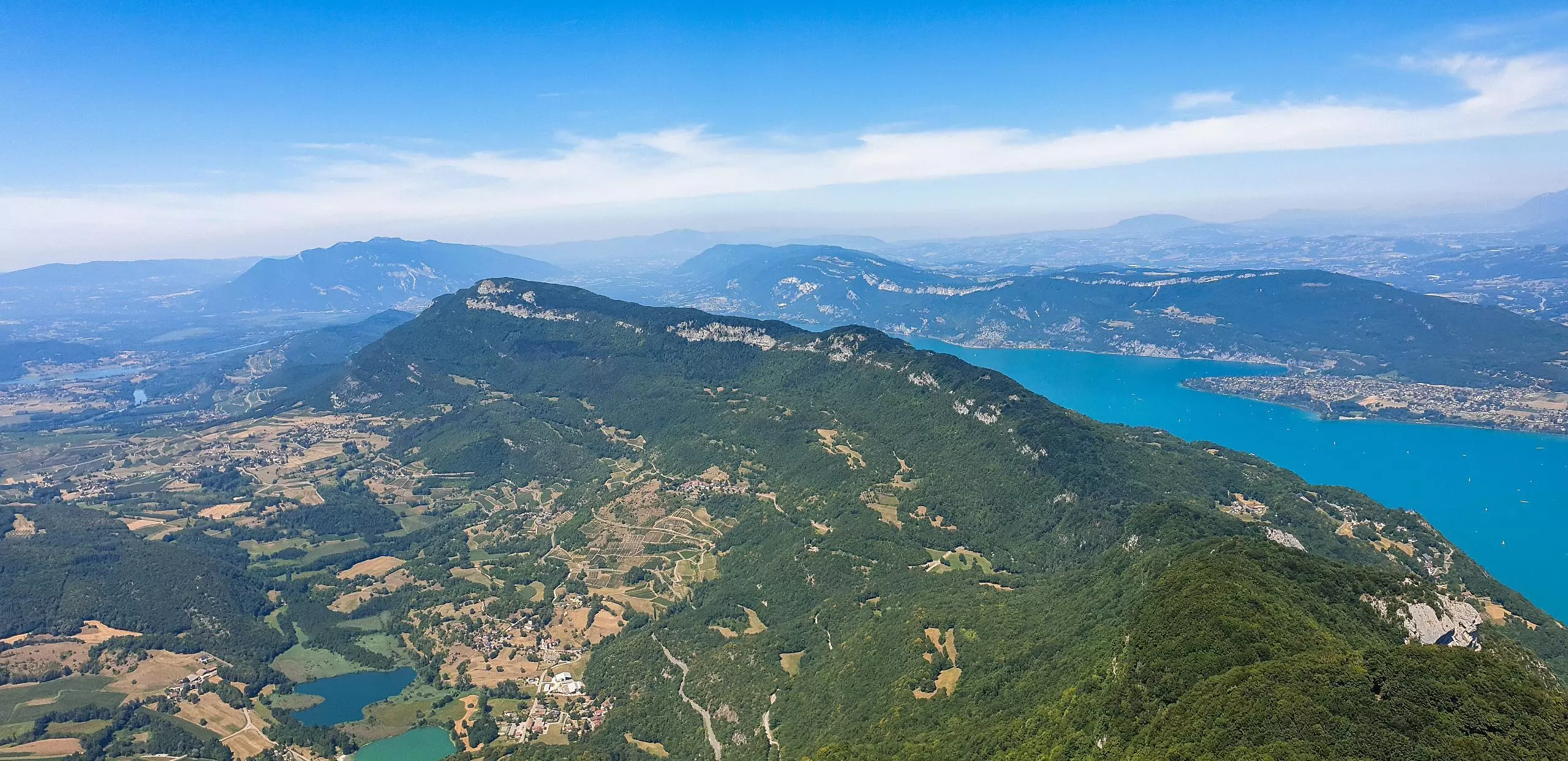
This hiking trail covers 4.971mi starting from La Chapelle-du-Mont-du-Chat, Savoie. The hike is a loop trail and returns to the trailhead. This hike is rated as hard, plan for about 7h2m to complete it. The route has an elevation gain of 2966ft and an elevation loss of 2946ft.

Description of the route by the creator

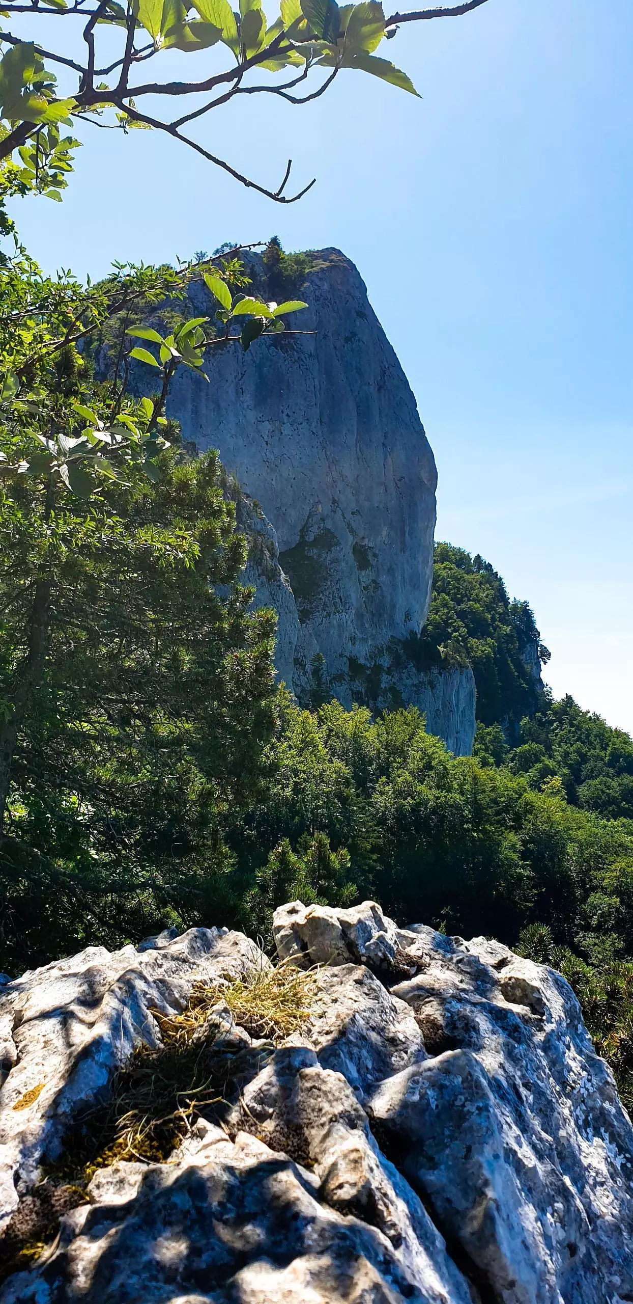
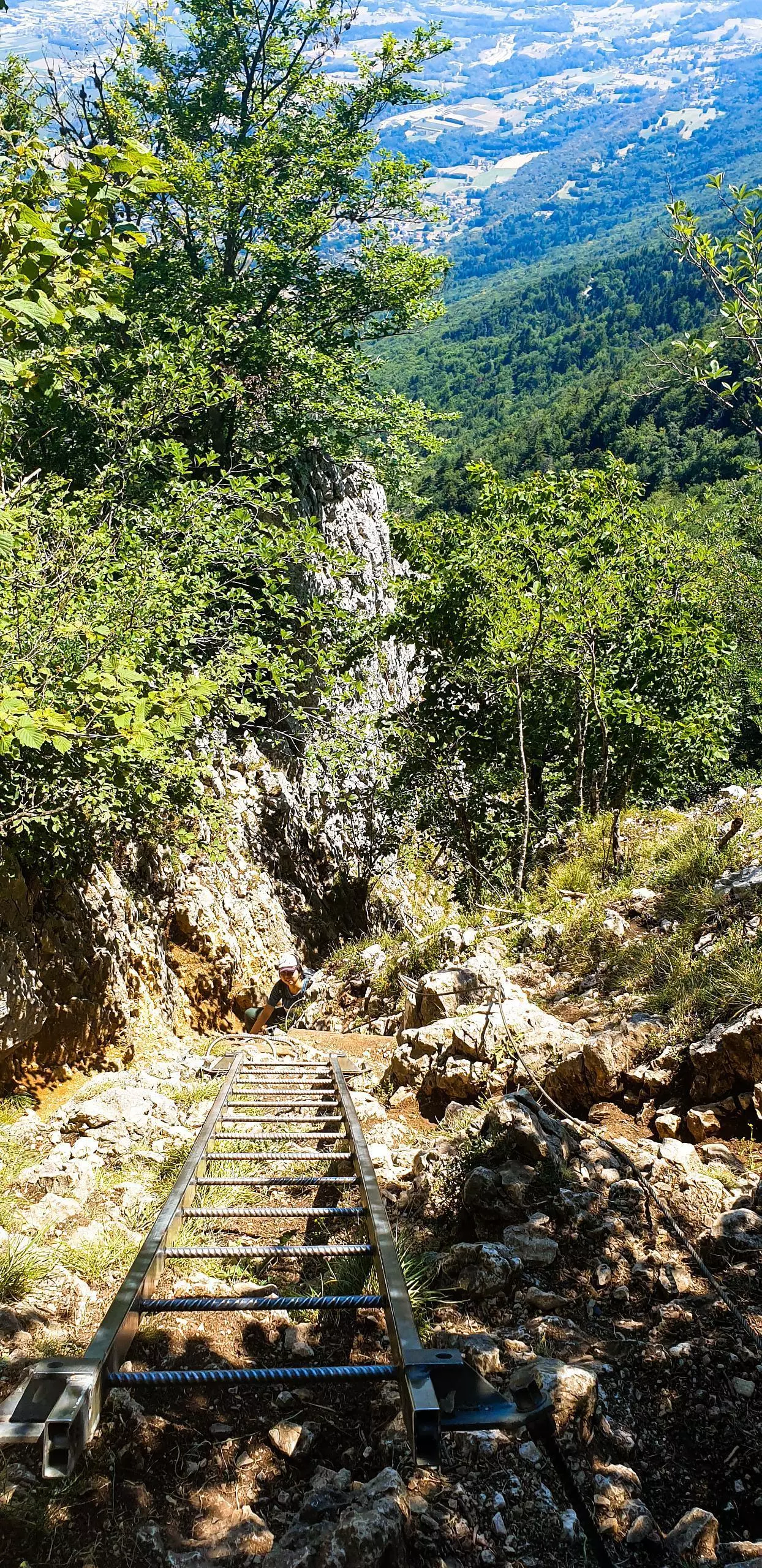
The departure is at the Col du Chat. A large parking lot is available just after the pass. The path leaves from the parking lot. The path is well indicated, follow the signs that indicate the "Dent du Chat". Follow the same path on the way back. The only difficult part is just before reaching the top of the tooth. You have to use ladders to climb to the top of the tooth.

(Description automatically translated)

Route profile

2966ft
Elevation gain
2946ft
Elevation loss
2093ft
Min altitude
4551ft
Max altitude

How to get there

Trailhead: 737 Route Du Col Du Chat, 73370 La Chapelle-du-Mont-du-Chat, France

GPS coordinates of the trailhead: 45.69229, 5.84826 / 45°41'32'' N, 5°50'53'' E

Caution: May Cross Private Property

This route may pass through or near private property. Always respect posted signs, obtain permission where required, and follow local trespassing laws. MapPlanner does not guarantee public access along any route.

Safety Notice

Trail and road conditions may change without notice due to weather, construction, or other factors. Always verify current conditions before heading out. You are responsible for your own safety — follow local signage, obey traffic laws, and use your best judgment on the trail.