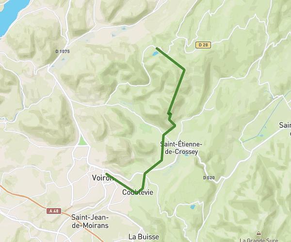
This hiking trail covers 7.622mi starting from La Bâtie-Montgascon, Isère. The hike does not return to the trailhead and ends near 26 Rue Voltaire, 38490 Les Abrets en Dauphiné, France. This hike is rated as moderate, plan for about 1h45m to complete it. The route has an elevation gain of 741ft and an elevation loss of 630ft.
pp1
Route details
4.35mph
Speed
759 kcal
Calories burned
3.4%
Avg grade
Point to point
Route type
886ft
Min altitude
1322ft
Max altitude
Route profile
741ft
Elevation gain
630ft
Elevation loss
886ft
Min altitude
1322ft
Max altitude
How to get there
Trailhead: 94 Impasse De La Chapelière, 38110 La Bâtie-Montgascon, France
GPS coordinates of the trailhead: 45.580991, 5.53522 / 45°34'51'' N, 5°32'6'' E