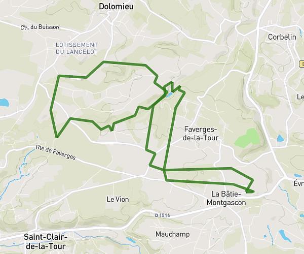
This hiking trail covers 4.612mi starting from Veyssilieu, Isère. The hike is a loop trail and returns to the trailhead. This hike is rated as moderate, plan for about 1h50m to complete it. The route has an elevation gain of 876ft and an elevation loss of 869ft.
Journée des amis
Route details
2.52mph
Speed
816 kcal
Calories burned
7.2%
Avg grade
Loop trail
Route type
932ft
Min altitude
1316ft
Max altitude
Route profile
876ft
Elevation gain
869ft
Elevation loss
932ft
Min altitude
1316ft
Max altitude
How to get there
Trailhead: 75 Chemin De Bramafant, 38460 Veyssilieu, France
GPS coordinates of the trailhead: 45.681311, 5.219503 / 45°40'52'' N, 5°13'10'' E