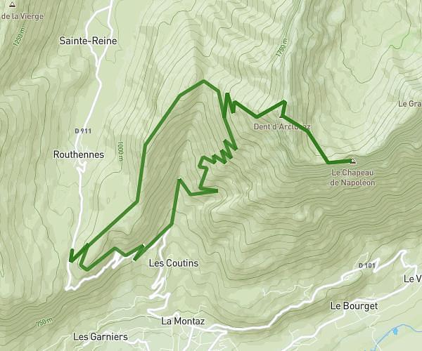
This hiking trail covers 6.092mi starting from Viuz-la-Chiésaz, Haute-Savoie. The hike is a loop trail and returns to the trailhead. This hike is rated as strenuous, plan for about 4h to complete it. The route has an elevation gain of 3133ft and an elevation loss of 3110ft.
Semnoz
Route details
1.52mph
Speed
1953 kcal
Calories burned
19.4%
Avg grade
Loop trail
Route type
2451ft
Min altitude
5551ft
Max altitude
Steep climb
Route profile
3133ft
Elevation gain
3110ft
Elevation loss
2451ft
Min altitude
5551ft
Max altitude
How to get there
Trailhead: 200 Route Des Granges, 74540 Viuz-la-Chiésaz, France
GPS coordinates of the trailhead: 45.807304, 6.071787 / 45°48'26'' N, 6°4'18'' E