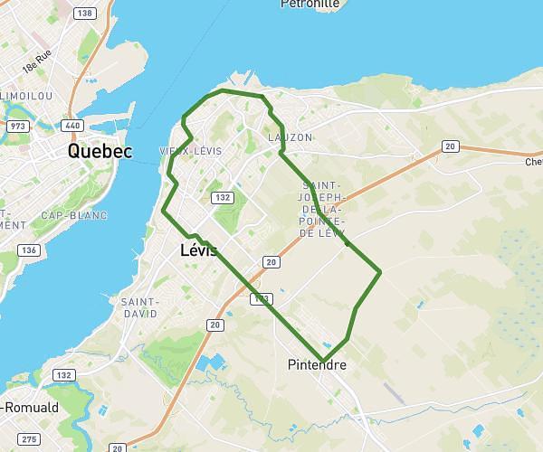
This hiking trail covers 2.9mi starting from Québec, Quebec. The hike does not return to the trailhead and ends near 580 Côte Bédard, Québec, Quebec G2M 1J5, Canada. This hike is rated as easy, plan for about 1h to complete it. The route has an elevation gain of 285ft and an elevation loss of 253ft.
Se tenir en forme
Route details
2.9mph
Speed
433 kcal
Calories burned
3.5%
Avg grade
Point to point
Route type
548ft
Min altitude
751ft
Max altitude
Route profile
285ft
Elevation gain
253ft
Elevation loss
548ft
Min altitude
751ft
Max altitude
How to get there
Trailhead: 20618 Boulevard Henri-Bourassa, Québec, Quebec G2M 1L3, Canada
GPS coordinates of the trailhead: 46.9039, -71.31292 / 46°54'14'' N, 71°18'46'' W