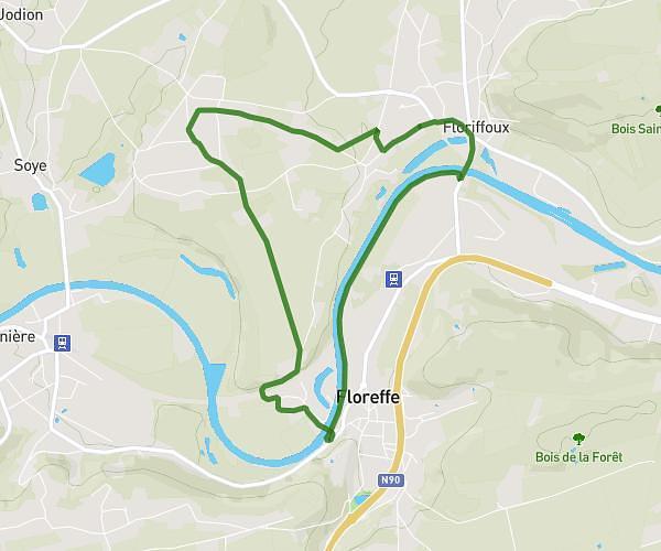
This walking route covers 3.106mi starting from Sambreville, Namur. The walk is a loop trail and returns to the trailhead. This walk is rated as easy, plan for about 1h11m to complete it. The route has an elevation gain of 374ft and an elevation loss of 374ft.
Houblonneuse
Route details
23:09/mi
Pace
294 kcal
Calories burned
Loop trail
Route type
315ft
Min altitude
515ft
Max altitude
Route profile
374ft
Elevation gain
374ft
Elevation loss
315ft
Min altitude
515ft
Max altitude
How to get there
Trailhead: Rue Du Chef-Lieu, 5060 Sambreville
GPS coordinates of the trailhead: 50.42592, 4.62688 / 50°25'33'' N, 4°37'36'' E