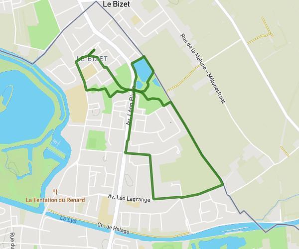
This hiking trail covers 3.557mi starting from Hazebrouck, Nord. The hike is a loop trail and returns to the trailhead. This hike is rated as easy, plan for about 5m39s to complete it. The route has an elevation gain of 164ft and an elevation loss of 154ft.
5 KM MARCHE OCTOBRE ROSE
Route details
37.77mph
Speed
40 kcal
Calories burned
1.7%
Avg grade
Loop trail
Route type
69ft
Min altitude
118ft
Max altitude
Route profile
164ft
Elevation gain
154ft
Elevation loss
69ft
Min altitude
118ft
Max altitude
How to get there
Trailhead: 57 Place Du Général De Gaulle, 59190 Hazebrouck, France
GPS coordinates of the trailhead: 50.721986, 2.536208 / 50°43'19'' N, 2°32'10'' E