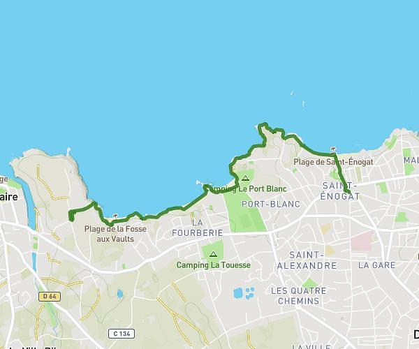
This walking route covers 1.943mi starting from Saint-Lunaire, Ille-et-Vilaine. The walk does not return to the trailhead and ends near 1 Avenue Du Château Hébert, 35800 Dinard, France. This walk is rated as easy, plan for about 19m to complete it. The route has an elevation gain of 282ft and an elevation loss of 374ft.
Saint Lunaire Hayes a Dinard Thalasso GR34
Route details
9:47/mi
Pace
78 kcal
Calories burned
Point to point
Route type
0ft
Min altitude
112ft
Max altitude
Route profile
282ft
Elevation gain
374ft
Elevation loss
0ft
Min altitude
112ft
Max altitude
How to get there
Trailhead: 614 Chemin Du Nick, 35800 Saint-Lunaire, France
GPS coordinates of the trailhead: 48.63429, -2.09889 / 48°38'3'' N, 2°5'56'' W