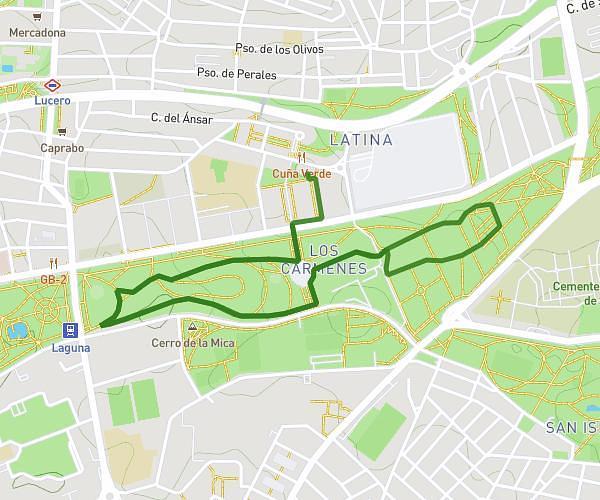
This running route covers 1.728mi starting from Madrid, Madrid. The run is a loop trail and returns to the trailhead. This run is rated as easy, expect about 2m to complete it. The route has an elevation gain of 52ft and an elevation loss of 62ft.
Park madrdud
Route details
51.84mph
Speed
23 kcal
Calories burned
Loop trail
Route type
2162ft
Min altitude
2224ft
Max altitude
Route profile
52ft
Elevation gain
62ft
Elevation loss
2162ft
Min altitude
2224ft
Max altitude
How to get there
Trailhead: Calle De Alfonso Xii 20, 28014 Madrid, Madrid, Spain
GPS coordinates of the trailhead: 40.417178, -3.688984 / 40°25'1'' N, 3°41'20'' W