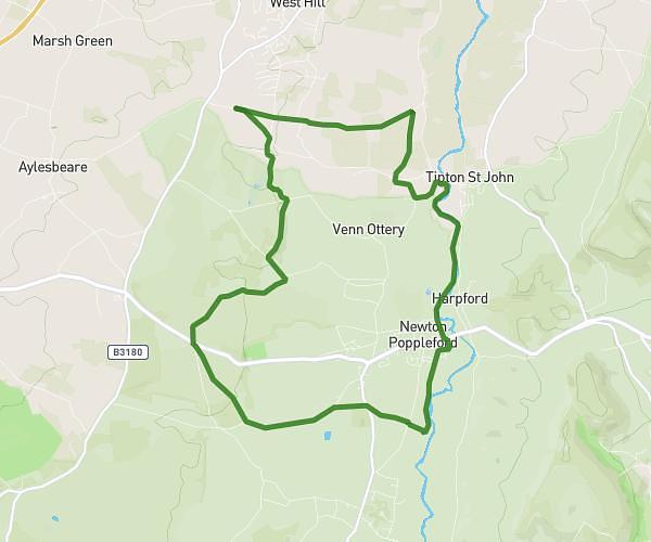
This walking route covers 5.029mi starting from Axminster, England. The walk is a loop trail and returns to the trailhead. This walk is rated as hard, plan for about 1h48m to complete it. The route has an elevation gain of 617ft and an elevation loss of 617ft.
Membury final
Route details
21:27/mi
Pace
441 kcal
Calories burned
Loop trail
Route type
413ft
Min altitude
755ft
Max altitude
Route profile
617ft
Elevation gain
617ft
Elevation loss
413ft
Min altitude
755ft
Max altitude
How to get there
Trailhead: Bakers Lane, Membury, Axminster, EX13 7AF, United Kingdom
GPS coordinates of the trailhead: 50.82183, -3.02811 / 50°49'18'' N, 3°1'41'' W