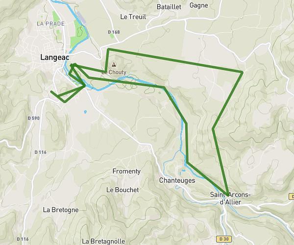
This running route covers 12.45mi starting from Brioude, Haute-Loire. The run is a loop trail and returns to the trailhead. This run is rated as strenuous, expect about 2h to complete it. The route has an elevation gain of 2405ft and an elevation loss of 2408ft.
Kngn
Route details
6.23mph
Speed
1372 kcal
Calories burned
Loop trail
Route type
1483ft
Min altitude
2254ft
Max altitude
Route profile
2405ft
Elevation gain
2408ft
Elevation loss
1483ft
Min altitude
2254ft
Max altitude
How to get there
Trailhead: Rue Marie Et Pierre Curie, 43100 Brioude
GPS coordinates of the trailhead: 45.28993, 3.38247 / 45°17'23'' N, 3°22'56'' E