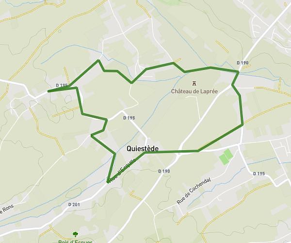
This hiking trail covers 4.235mi starting from Bellinghem, Pas-de-Calais. The hike is a loop trail and returns to the trailhead. This hike is rated as easy, plan for about 1h21m to complete it. The route has an elevation gain of 282ft and an elevation loss of 282ft.
Rando Inghem
Route details
3.11mph
Speed
584 kcal
Calories burned
2.5%
Avg grade
Loop trail
Route type
154ft
Min altitude
308ft
Max altitude
Route profile
282ft
Elevation gain
282ft
Elevation loss
154ft
Min altitude
308ft
Max altitude
How to get there
Trailhead: 58 Rue D'helfaut, 62129 Bellinghem, France
GPS coordinates of the trailhead: 50.668038, 2.243684 / 50°40'4'' N, 2°14'37'' E